Service Area — Horry County, SC
Excavation & Land Clearing Horry County
Horry County spans the South Carolina coast from the North Carolina line through the Myrtle Beach area and inland to the county seat at Conway, covering developed beachfront communities, established residential neighborhoods, and rural acreage. Sholmes Consulting Excavation & Land Clearing helps property owners define a realistic site-preparation scope that matches the parcel, the access, and the intended construction. Share your project details and we will discuss the approach for your Horry County property.
Excavation & Land Clearing in Horry County
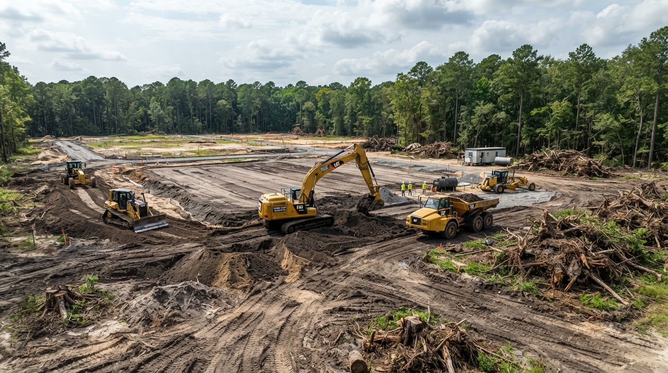
Preparing a Horry County property for construction usually combines vegetation clearing, stump and root treatment, excavation, building-pad construction, grading, and driveway access. The scope is matched to the approved plans and the actual parcel rather than applied across the entire property. A developed coastal lot with existing improvements carries different access and utility considerations than an inland rural acreage project, and the approach is adjusted accordingly rather than treated as identical.
Residential Lot Clearing near Myrtle Beach
Selective clearing removes the trees, brush, and stumps within the approved building footprint, the driveway, and the construction access while retaining vegetation outside the work area. Wooded residential lots are opened for the proposed home without clearing the entire parcel, and the clearing limits are established from the approved plans and the property boundaries.
Commercial Site Preparation near Conway
Commercial excavation addresses the larger building footprints, the parking and access areas, the utility coordination, and the grading required for a commercial or mixed-use project. The scope is matched to the approved commercial site plans, the existing improvements, and the property access so the earthwork supports the proposed development.
Rural Acreage Clearing & Forestry Mulching
Rural acreage clearing manages the larger wooded parcels, the overgrown brush, and the timber residue through forestry mulching, stump removal, and root raking. The level of clearing depends on the approved work boundaries and the intended property use, and selective clearing retains vegetation outside the work area where appropriate.
Building Pads, Grading & Access Construction
After clearing, the site may require grubbing, suitable fill placement, compaction, grading to the proposed elevations, and building-pad construction. Gravel driveways and access roads are coordinated with the grading so machinery can reach the work area, and the pad is matched to the existing grades and the soil conditions rather than a universal fill height.
Residential & Commercial Demolition across Horry County
Where an existing structure needs to come down before a new build or a property improvement, the demolition scope is matched to the actual structure and the approved redevelopment plan. Residential demolition removes a house or a detached building; commercial structure demolition clears a larger building and its foundation; mobile home removal addresses an older manufactured home; and garages, sheds, and outbuildings each carry different removal considerations. Storm-damaged structures may require a separate structural assessment before demolition proceeds.
Concrete and slab removal, interior selective demolition, debris hauling, and site restoration are coordinated with the demolition so the cleared area is left ready for the follow-up earthwork. Utility coordination is handled before structural removal begins so active water, sewer, electrical, and gas connections are safely disconnected. Demolition is distinct from new construction and from hazardous-material remediation — where asbestos, lead, or other regulated materials are suspected, the appropriate professional assessment and notifications are handled before structural removal begins. We do not perform environmental remediation or structural engineering unless that capability is confirmed, and project authorization and applicable approvals are verified for each parcel.
Drainage & Stormwater Services in Horry County
Drainage planning for a Horry County property begins with the existing elevations and the proposed grades, then matches the approach to the actual runoff, the available outlets, and the groundwater conditions. Horry County includes coastal communities, riverine areas along the Waccamaw River, and inland properties with widely differing drainage characteristics. Not every Horry County parcel is flood-prone, and grading does not eliminate flood risk — the actual conditions are confirmed for the specific parcel.
Yard Drainage and Surface Grading
Yard drainage work addresses surface runoff, low areas, downspout discharge, and the existing lot elevations. The approach may include regrading a low area, routing roof runoff through an appropriate underground line, or shaping a swale to move water toward an authorized outlet. The solution is matched to the actual cause of the standing water.
Culverts & Ditches near Conway
Culverts, ditches, and catch basins manage the runoff that the new grades and the new surfaces generate. Private drainage is not connected to public stormwater systems without the applicable authorization, and the existing drainage infrastructure is reviewed against the proposed work so it is not blocked or redirected without approval.
Stormwater Infrastructure & Building Pad Drainage
For a proposed new home or commercial building, the lot drainage is coordinated with the building-pad grading, the driveway, the roof runoff, and the existing neighborhood infrastructure. Swales, catch basins, underground drainage, and culverts are considered where the approved plans call for them, and the drainage outlet and the capacity are confirmed before installation.
Floodplain Planning near Coastal and River Communities
Coastal and riverine floodplain review is relevant to some Horry County properties, particularly where fill placement, grading, or work near a waterway is proposed. The actual flood hazard is confirmed for the specific parcel through FEMA mapping and the applicable local floodplain administrator rather than assumed countywide. We do not claim grading eliminates flood risk.
Planning Excavation Projects across Horry County
A realistic Horry County estimate starts with accurate project information. The scope differs between new construction, property improvements, and redevelopment projects, and the applicable jurisdiction differs between incorporated municipalities and unincorporated county property. The more that is known about the parcel and the intended work, the more useful the scope and the pricing discussion.
Information That Shapes a Horry County Estimate
- Parcel boundaries and ownership
- Property survey and existing conditions
- Municipal or unincorporated jurisdiction
- Equipment access and site entry
- Existing utilities and drainage
- Vegetation and tree-retention requirements
- Approved construction plans and grading quantities
- Material handling and fill requirements
- Proposed project scope and building footprint
- Desired timeline and intended construction
Where a survey or approved site plan is not yet available, we can discuss the project from the parcel information and the intended construction, then refine the scope as the plans develop. We do not invent fixed per-acre or per-lot prices.
Horry County Communities & Site Development
Horry County's incorporated municipalities maintain their own planning, zoning, and building authorities, while unincorporated property falls under county jurisdiction. The applicable authority is confirmed for each parcel rather than assumed from a mailing address. Community pages are available for the areas below where site-specific information is useful.
Myrtle Beach Area Communities
Carolina Forest, Market Common, Socastee, Forestbrook, Burgess, Surfside Beach, and Garden City where the property falls within Horry County. These communities include a mix of planned residential development, established mixed-use property, and coastal residential sites.
North Myrtle Beach Area Communities
North Myrtle Beach, Cherry Grove, Windy Hill, Little River, and Atlantic Beach. The City of North Myrtle Beach and the Town of Atlantic Beach maintain separate municipal authorities, and Little River is an unincorporated community under county jurisdiction.
Conway Area Communities
Conway, Homewood, Bucksport, and Red Hill. The City of Conway is the county seat with its own planning and construction services departments, while Homewood, Bucksport, and Red Hill are unincorporated communities under Horry County jurisdiction.
Rural Communities
Aynor, Loris, Longs, Green Sea, and Galivants Ferry. These unincorporated communities include rural residential acreage, wooded homesites, agricultural land, and river-adjacent property. The Town of Aynor and the City of Loris are incorporated municipalities with their own zoning processes.
The broader Murrells Inlet area crosses the Horry and Georgetown county boundary, so a Murrells Inlet property's actual county is confirmed before the applicable jurisdiction is assigned. Nichols is not part of Horry County — it is an incorporated town in Marion County. Horry County jurisdiction over unincorporated property covers planning, zoning, code enforcement, and stormwater review, while incorporated municipalities administer their own land-development and building processes. Road-access jurisdiction depends on the road authority, and applicable state and federal requirements are confirmed where a project involves wetlands, coastal critical areas, or federal aquatic resources.
Coastal, Inland & Municipal Site Planning across Horry County
Horry County spans developed Grand Strand properties, inland residential construction, rural acreage, riverine areas, and commercial projects, and the site work across the county is planned around those differences rather than a single approach. A developed coastal lot with existing improvements carries different access, utility, and floodplain considerations than an inland rural acreage project or a commercial site, and the incorporated municipalities maintain their own planning, zoning, and building authorities separate from the county's review of unincorporated property. The applicable jurisdiction is confirmed for each parcel through county and municipal mapping and records before the requirements are assigned.
Developed Grand Strand, Inland & Rural Acreage Differences
Developed Grand Strand properties may involve selective demolition and grading around existing structures, inland residential construction may need lot clearing and building-pad work, and rural acreage may call for forestry mulching, stump removal, and private access-road construction. Two planning considerations follow: the property's actual jurisdiction — incorporated municipality or unincorporated county — is confirmed before the review is assigned, and the road-access authority and the environmental dependencies (stormwater, floodplain, wetland, or coastal review) are verified for the specific parcel rather than assumed countywide.
Municipal Versus Unincorporated Review & Environmental Dependencies
Incorporated municipalities — including Myrtle Beach, North Myrtle Beach, Conway, Surfside Beach, Atlantic Beach, Aynor, and Loris — administer their own land-development and building processes, while unincorporated property falls under Horry County planning, zoning, code enforcement, and stormwater review. Riverine areas along the Waccamaw and coastal conditions affect some properties, but not every Horry County parcel is flood-prone, and grading does not eliminate flood risk. Nichols is excluded from Horry County jurisdiction — it is an incorporated town in Marion County.
The practical takeaway is that a Horry County project is planned around the property's actual type and its verified municipal or unincorporated jurisdiction, with the environmental dependencies confirmed for the specific parcel. Related planning resources include SC land-disturbance & stormwater permit guide, flood mitigation grading, and the Georgetown County service-area overview.
Horry County Excavation & Land Clearing FAQs
Discuss Your Horry County Property Project
Share the parcel identification, the property survey, the proposed project scope, the existing structures, the equipment access, and any available site plans. We will discuss the clearing, grading, demolition, and drainage scope under the applicable jurisdiction for your Horry County property.