
Service Area — Burgess, SC
Excavation & Land Clearing Burgess
Burgess is a growing community where property improvement, planned residential construction, and other suitable site-work projects often begin with land clearing and earthwork. Sholmes Consulting Excavation & Land Clearing helps landowners define a realistic preparation scope that matches the parcel, the access, and the intended use. Share your project and we will discuss the approach for your Burgess property.
Land Clearing & Site Work near Burgess
Burgess parcels range from overgrown ground that needs vegetation removal to partially prepared sites that need grading and building-pad construction. The scope is matched to the vegetation, the access limits, the root and stump treatment, the fill material, and the proposed construction footprint.
Vacant and Overgrown Property Clearing
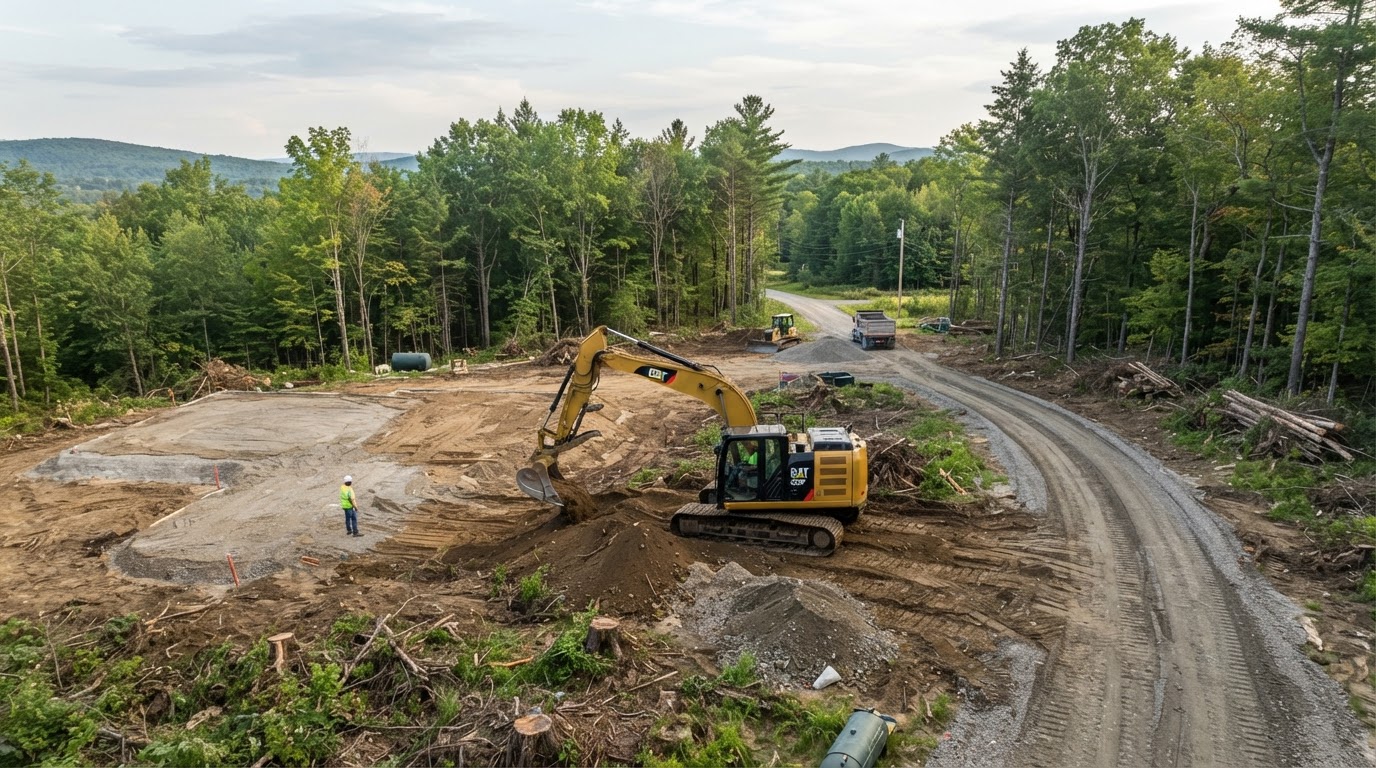
Vacant or overgrown Burgess parcels are cleared selectively within the approved work area so the retained trees and the neighboring properties are protected. The vegetation, the brush, and the stumps within the footprint are removed, and the debris is handled and hauled so the cleared area is ready for the follow-up earthwork. Clearing limits are established from the approved plans and the property boundaries.
Building Pad Construction in Burgess
After clearing, the site may require grubbing and root raking, suitable fill placement, compaction, and grading to the proposed elevations. The building pad is constructed to the approved grades so the proposed construction sits on a prepared surface. The pad is matched to the existing grades, the soil conditions, and the approved plans rather than a universal fill height.
Driveway Access and Grading
Driveway and equipment access is coordinated with the clearing and the grading so machinery can reach the work area without damaging the retained portions of the parcel. The access route may involve a gravel entrance, a culvert crossing, and a cleared corridor sized for the equipment. Where the road is maintained by a state or local authority, the applicable encroachment requirements are confirmed.
Demolition & Property Removal in Burgess
Where an existing structure needs to come down before a new build or a property improvement, the demolition scope is matched to the actual structure. Detached structures, residential demolition, mobile home removal, and existing concrete removal each carry different removal considerations, and the debris is hauled and the site is restored so the cleared area is ready for the follow-up earthwork.
The required approvals and the demolition scope vary by the structure, the location, and the proposed redevelopment. Demolition is distinct from hazardous-material remediation — where regulated materials are suspected, the appropriate professional assessment and notifications are handled before structural removal begins. We do not perform environmental remediation or structural engineering unless that capability is confirmed.
Drainage & Ground Elevation Planning near Burgess
Drainage planning for a Burgess parcel begins with the existing grades and the available outlets, then matches the approach to the actual runoff and the groundwater conditions.
Residential Surface Drainage
Surface drainage addresses the existing grades, the drainage routes, the runoff, and the available outlets. The approach may include regrading a low area, shaping a swale, or routing roof runoff through an appropriate underground line. The solution is matched to the actual cause of the standing water rather than applied uniformly, and private drainage is not connected to public infrastructure without the applicable authorization.
Lot Grading and Building Preparation
Lot grading and building-pad preparation are coordinated so the pad integrates with the surrounding grade and the drainage. The existing grades, the approved fill, the runoff, the groundwater considerations, and the access all shape the grading scope. Where flood-related elevation requirements apply, the applicable base flood elevation and the local floodplain review are confirmed before the pad is planned.
Planning Excavation and Clearing in Burgess
A realistic estimate starts with the parcel boundaries, the clearing limits, the available plans, and the existing access. The utility conflicts, the approved grades, and the material handling all shape the scope.
What Shapes a Burgess Estimate
- Parcel boundaries and clearing limits
- Available plans and approved grades
- Existing access and equipment maneuvering
- Utility conflicts
- Vegetation density and tree quantities
- Soil and groundwater conditions where known
- Fill material and material handling
- Drainage routes and available outlets
- Intended use and desired timeline
- Land-disturbance or floodplain review where applicable
We do not invent fixed prices. The estimate reflects the actual parcel and the proposed work.
Burgess Property Preparation Considerations
Burgess combines established properties with parcels that still need site preparation. The residential site improvements, the undeveloped parcels, the lot access, the tree retention, the existing drainage infrastructure, and the subdivision requirements where applicable all shape what site work is appropriate for a given parcel.
Established Properties and Undeveloped Parcels
Established Burgess properties may need selective demolition, regrading, or drainage improvement, while undeveloped parcels may need full clearing and building-pad preparation. The lot access, the tree retention, and the existing drainage infrastructure are reviewed against the proposed work so the clearing and grading match the approved footprint and the retained vegetation. Where a subdivision carries requirements, those documents are confirmed for the specific lot rather than assumed to apply community-wide.
Horry County Planning and Development Review
Burgess is an unincorporated community, so many land-disturbance, stormwater, and floodplain questions are addressed through Horry County planning and development review. The actual parcel jurisdiction and the property-specific requirements are confirmed for the specific parcel before the work is planned. We do not assume unincorporated county standards apply to every lot or that a municipal review applies where it does not.
Property Development & Ground Preparation near Burgess
Burgess combines existing residential parcels with undeveloped lots that may be opened for construction, and that mix shapes how excavation, clearing, grading, and drainage work is planned here. An existing-property improvement carries different access and utility considerations than opening a vacant lot, and the proposed grading is reviewed against the available drainage outlets so the work does not create runoff problems for the parcel or the neighboring properties.
Existing Parcels, Undeveloped Lots & Vegetation
Existing residential parcels may involve selective clearing, driveway regrading, or demolition of a detached structure, while undeveloped lots may need full lot clearing, building-pad construction, and access earthwork. The vegetation, the stump and root conditions, and the approved work boundaries define the clearing scope rather than the entire property. Two planning considerations follow: the parcel's existing conditions and access are confirmed before the scope is set, and the fill placement is matched to the approved grades and the soil conditions rather than a universal fill height.
Grading, Fill Placement & Drainage Outlets
Grading and fill placement are coordinated with the building-pad construction so the pad sits on a prepared, stable surface, and the proposed grades are reviewed against the available drainage outlets — ditches, swales, or conveyance — so surface runoff is directed to an authorized point rather than pooling or discharging onto a neighboring property. Approved lot raising is distinct from ordinary surface grading: raising a pad changes the elevation to the approved design, while surface grading shapes the existing ground. Burgess is an unincorporated Horry County community, so applicable county review is confirmed for the specific parcel.
The practical takeaway is that a Burgess project is planned around the parcel's actual conditions — its existing improvements, its vegetation, its access, and its drainage outlets — and the approved grading is distinguished from ordinary surface work. Related planning resources include lot raising & pad elevation, grading & land leveling, and the Horry County service-area overview.
Burgess Excavation & Land Clearing FAQs
Discuss Your Burgess Property Project
Share the parcel boundaries, the clearing limits, the available plans, the existing access, and the intended use. If land-disturbance, floodplain, or road-encroachment review applies, we will discuss the clearing, grading, and drainage scope under the applicable rules for your Burgess property.
Related Services
Horry County service-area coverage is planned for a later phase. Links to that page will activate once it is built.