Service Area — Bucksport, SC
Excavation & Land Clearing Bucksport
Bucksport is an unincorporated Horry County community in the Waccamaw and Little Pee Dee river region, where rural property earthwork, drainage, and flood-related planning are part of many site projects. Sholmes Consulting Excavation & Land Clearing helps landowners define a realistic preparation scope that matches the parcel, the access, and the actual site conditions. Share your project and we will discuss the approach for your Bucksport property.
Excavation & Land Clearing in Bucksport
Preparing a Bucksport property combines vegetation removal, stump and root work, excavation, approved grading, building-pad construction, fill planning, and material hauling. The scope is matched to the wooded property, the access, and the clearing boundaries, and we do not suggest any particular property is suitable for raising, filling, or development without assessment.
Rural Property and Lot Clearing
Vegetation removal on a wooded Bucksport property is performed selectively within the approved work area so the retained trees and the neighboring properties are protected. The brush, the trees, and the stumps within the footprint are removed, and the debris is handled and hauled so the cleared area is ready for the follow-up earthwork. Clearing limits are established from the approved plans and the property boundaries.
Homesite Site Preparation near Bucksport
After clearing, the site may require grubbing and root raking, suitable fill placement, compaction, and grading to the proposed elevations. The building pad is constructed to the approved grades so the proposed construction sits on a prepared surface, and the pad is matched to the existing grades and the soil conditions rather than a universal fill height.
Driveway and Access Road Construction
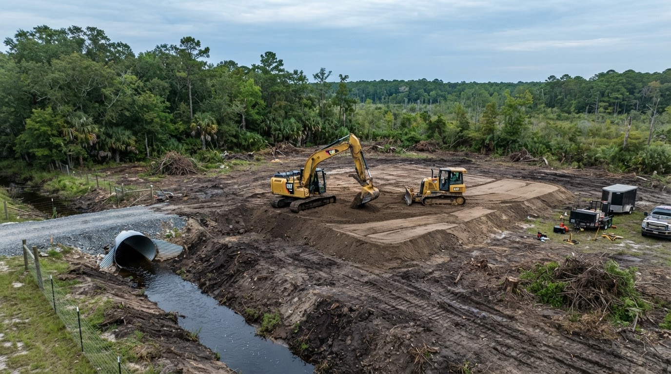
Driveway and access road preparation is coordinated with the clearing and the grading so equipment can reach the work area. The access may involve a gravel entrance, a culvert crossing, and a cleared corridor, and where the road is maintained by a state or local authority the applicable encroachment requirements are confirmed. Rural access that is affected by high-water events is planned with that consideration in mind.
Grading and Fill Planning
Grading and fill planning address the existing grades, the proposed elevations, and the material handling. Where flood-related elevation requirements apply, the applicable base flood elevation and the local floodplain review are confirmed before the pad is planned. Fill placement in a floodplain or a wetland may require separate review, and the grading is coordinated with the drainage so the runoff is managed rather than redirected onto a neighboring parcel.
Residential Demolition & Debris Removal near Bucksport
Where an existing structure needs to come down before a new build or a property improvement, the demolition scope is matched to the actual structure. Detached structures, existing residential demolition, mobile home removal where relevant, and concrete pad removal each carry different removal considerations, and the debris is hauled and the site is restored so the cleared area is ready for the follow-up earthwork.
Storm-related demolition planning is distinguished from ordinary clearing — where a structure has been damaged by a high-water event, the demolition scope is established from the actual damage and the appropriate professional evaluation. We do not imply unsafe structures may be entered before professional evaluation, and demolition is distinct from hazardous-material remediation. Where regulated materials are suspected, the appropriate professional assessment and notifications are handled before structural removal begins.
Drainage & Flood-Related Grading in Bucksport
Bucksport has documented historical flood concerns associated with the surrounding Waccamaw and Little Pee Dee river systems. Drainage planning begins with the existing ground elevations, the drainage routes, and the available outlets, then matches the approach to the actual runoff and the groundwater conditions. We do not claim drainage systems or raising a lot can prevent riverine flooding.
Rural Property Drainage and Ditches
Rural drainage ditches manage the surface runoff and the property access. The approach may include cleaning a ditch, shaping a swale, or installing a culvert crossing. The solution is matched to the actual drainage conditions rather than a uniform specification, and private drainage is not connected to public infrastructure without the applicable approval.
Culverts and Access Crossings near Bucksport
Culvert crossings manage the water that moves through the drainage routes and the access crossings. The culvert size, the placement, and the outlet are matched to the actual drainage conditions and the approved plans rather than a universal diameter. Where the crossing is part of an access road, the crossing is planned with the access so equipment can reach the work area.
Riverine Floodplain Planning
Riverine floodplain planning is relevant to some Bucksport properties because of the surrounding river systems, but not every Bucksport parcel lies in a mapped Special Flood Hazard Area. The actual flood hazard is confirmed for the specific parcel through FEMA mapping and the applicable local floodplain administrator. Where fill placement is proposed in a floodplain, the applicable review is confirmed before the work is planned.
Post-Flood Grading and Site Assessment
Post-flood grading and site assessment address the erosion, the displaced soil, the changed ground elevations, and the damaged drainage infrastructure that a high-water event can leave behind. The repair scope is established from the actual damage, and we do not encourage entry onto unstable or contaminated sites before professional evaluation. We do not claim post-flood work automatically qualifies for emergency permitting exemptions or insurance reimbursement.
Planning Excavation Projects near Bucksport
A realistic Bucksport estimate starts with the property ownership, the parcel boundaries, and the site access. Projects involving fill, ditches, culverts, or water-adjacent earthwork may need separate review, so the existing drainage infrastructure, the floodplain information, and the available site plans are reviewed before the scope is defined.
Information That Shapes a Bucksport Estimate
- Property ownership and parcel boundaries
- Site access and existing drainage infrastructure
- Floodplain information and available site plans
- Proposed work areas and utility locations
- Sediment and material handling
- Vegetation density and tree quantities
- Existing culverts and drainage routes
- Groundwater and soil conditions where known
- Project-specific approvals and intended use
- Wetland or waterway review where applicable
We do not invent fixed prices. The estimate reflects the actual parcel and the proposed work, and the flood hazard is confirmed for the specific parcel rather than assumed community-wide.
Bucksport Riverine Property & Site Planning
Bucksport is an unincorporated Horry County community in the region of the Waccamaw and Little Pee Dee river systems. Horry County has documented flood-related infrastructure planning for the Bucksport area, including the Big Bull Landing Road flood protection proposal. That is factual regional context, not evidence that a particular parcel is flood-prone or that the proposed project is completed. The actual conditions are confirmed for each parcel before the work is planned.
Riverine Water Conditions and Access
The surrounding river systems influence the groundwater, the drainage routes, and the property access during high-water events for some Bucksport properties. The existing roads, the drainage, and the ground elevations are reviewed against the proposed work so the clearing and the grading match the actual conditions. We do not prescribe universal flood elevations, fill depths, drainage solutions, or design specifications, and we do not claim every Bucksport parcel is within a mapped Special Flood Hazard Area.
Flood Risk, Grading, and Drainage Distinctions
Flood risk assessment, site grading, culvert installation, emergency access, engineered flood mitigation, and routine drainage maintenance are distinct activities. Grading and fill can manage surface runoff and raise a building pad, but they do not eliminate riverine flooding. Engineered flood mitigation is a separate professional matter, and where flood-related elevation requirements apply, the applicable base flood elevation and the local floodplain review are confirmed before the pad is planned.
County Drainage Infrastructure and Property-Specific Constraints
Horry County maintains drainage infrastructure and flood-related resources that are relevant to some Bucksport properties, including the infrastructure and regulation projects dashboard and the river gauge resources. These are used as factual regional context, not as evidence that Sholmes performed the county's flood mitigation work or that a particular parcel shares the same conditions. The property-specific constraints — the existing structures, the approved grading and fill, and the potential wetland and waterway review — are confirmed for each parcel before the work is planned.
Riverine Property Access & Earthwork in Bucksport
Bucksport is an unincorporated Horry County community in the region of the Waccamaw and Little Pee Dee river systems, and that riverine context shapes how excavation, clearing, grading, and drainage work is planned here. The site work is planned around rural access, culverts, approved fill, and the property-specific floodplain information that may apply to some parcels. Horry County has documented flood-related infrastructure planning for the area, including the Big Bull Landing Road flood protection proposal — used here as factual regional context, not as evidence that a particular parcel is flood-prone or that the proposed project is completed.
Rural Access, Culverts & Drainage Routes
Rural property access may involve private roads, culvert crossings, and ditch systems that are evaluated against the actual drainage conditions and the road authority. The clearing and grading scope is matched to the approved work boundaries and the existing elevations. Two planning considerations follow: the culvert and drainage-route conditions are confirmed before any modification, and the approved fill placement is matched to the property-specific floodplain information rather than a universal fill depth.
Riverine Floodplain & Practical Site Limitations
The property-specific floodplain information is confirmed through FEMA mapping and the applicable local floodplain administrator, and where a parcel is waterway-adjacent the potential wetland or waterway review is confirmed for that parcel. Not every Bucksport parcel is within a mapped Special Flood Hazard Area, and drainage systems or raising a lot do not prevent riverine flooding. Flood risk assessment, site grading, culvert installation, and engineered flood mitigation are distinguished as separate matters, and unincorporated Horry County review applies to the specific parcel.
The practical takeaway is that a Bucksport project is planned around its riverine context — rural access, culverts, drainage, and property-specific floodplain review — under unincorporated Horry County jurisdiction. Related planning resources include culvert installation, post-flood yard regrading, and the Horry County service-area overview.
Bucksport Excavation & Drainage FAQs
Discuss Excavation & Drainage Planning in Bucksport
Share the property ownership, the parcel boundaries, the site access, the existing drainage infrastructure, and the floodplain information. If floodplain, wetland, or waterway review applies, we will discuss the clearing, grading, and drainage scope under the applicable rules for your Bucksport property.
Related Services
Horry County service-area coverage is planned for a later phase. Links to that page will activate once it is built.