
Service Area — Cherry Grove, SC
Excavation & Land Clearing Cherry Grove
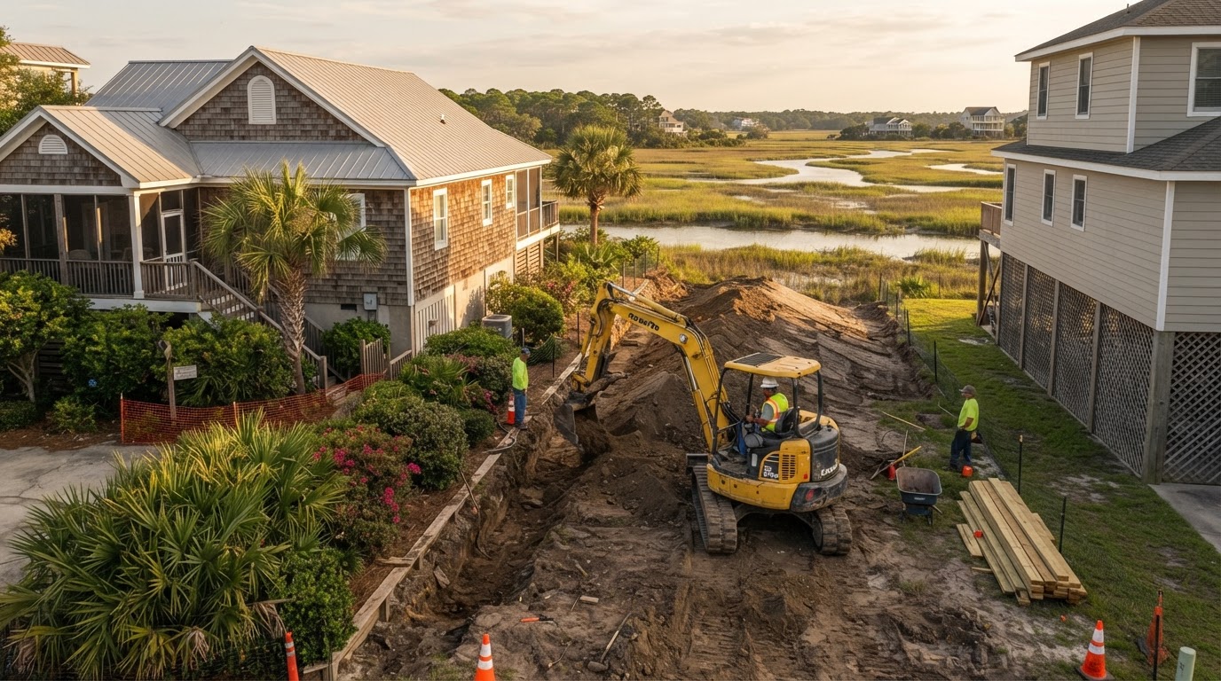
Cherry Grove is an established coastal community where site work usually means excavation, grading, selective clearing, and demolition around existing homes rather than clearing raw acreage. Sholmes Consulting Excavation & Land Clearing helps property owners define a realistic scope that fits the tight lot access, the existing improvements, the coastal drainage, and the applicable municipal review. Share your project and we will discuss the approach for your Cherry Grove property.
Excavation & Site Preparation in Cherry Grove
Cherry Grove properties are predominantly developed, so excavation here is selective and site-specific. The work is planned around the existing structures, the retained landscaping, the construction footprints, the ground elevations, the utilities, and the approved clearing limits rather than applied as broad acreage clearing.
Residential Property Excavation
Foundation-related excavation, grading around existing structures, and limited earthwork within the approved construction footprint are matched to the actual lot and the approved plans. The existing improvements and the tight access shape the equipment and the work boundaries.
Selective Lot Clearing near Cherry Grove
Where vegetation needs to come down, the clearing is selective — limited to the approved work area and the vegetation that actually requires removal. Retained trees and landscaping are protected by the clearing limits, which are established from the approved plans and the property boundaries.
Building Pad & Driveway Preparation
Where a new structure is planned, the building pad is constructed to the approved grades and the driveway and access are coordinated with the grading. The fill material, the compaction, and the elevations are matched to the approved plans and the existing ground conditions rather than a universal specification.
Excavation Around Existing Improvements
Work near existing structures requires careful access planning, utility confirmation, and material-hauling routes that protect the retained improvements and the neighboring properties. The disturbance stays within the approved limits so the existing development is not affected.
Cherry Grove is not primarily undeveloped timber acreage, so the excavation scope is planned from the developed lot, the existing improvements, and the approved plans. The material hauling, the utility coordination, and the access route are confirmed before the equipment is scheduled.
Residential Demolition near Cherry Grove
Where an existing structure needs to come down, the demolition scope is matched to the actual structure and the approved redevelopment plan. Existing residential structures, selective demolition, deck and porch removal, concrete slab removal, and detached structures each carry different removal considerations, and the debris is hauled and the site is restored so the cleared area is ready for the follow-up earthwork.
On developed Cherry Grove lots the demolition planning accounts for the adjacent homes, the access limitations, and the potential coastal project review. Where regulated materials are suspected, the appropriate professional assessment and the required notifications are handled before structural removal begins. Demolition is distinct from hazardous-material remediation and from structural engineering — we do not perform environmental remediation or structural engineering unless that capability is confirmed.
Coastal Drainage & Grading in Cherry Grove
Cherry Grove includes beachfront and marsh/channel environments, so drainage is a property-by-property question. The runoff, the groundwater, the existing drainage, the available outlets, and the coastal or tidal influences where applicable all shape the approach.
Surface Water and Property Elevations
The existing ground elevations and the surface runoff are reviewed against the proposed work so the grading moves water toward the intended outlet rather than pooling against a foundation or a neighboring lot. The approach is matched to the actual cause of the standing water rather than applied uniformly.
Drainage Planning near Cherry Grove Marsh
Where a parcel lies near a marsh or channel, the drainage outlets, the surface runoff, and the property elevations are reviewed against the proposed work. Coastal or environmental review may apply, but the applicable review is confirmed for the specific lot — we do not assume every Cherry Grove parcel borders a regulated wetland, marsh, or tidal channel.
Existing Structures and Underground Drainage
Existing underground drain lines, downspout connections, and conveyance pipes are reviewed against the proposed work so the clearing and grading do not block or redirect shared drainage without authorization. Private drainage is not connected to public stormwater infrastructure without the applicable authorization, and grading alone does not eliminate coastal flood risk.
Planning Property Excavation near Cherry Grove
A realistic estimate starts with accurate parcel and project information. The parcel boundaries, the site access, the existing utilities, the demolition logistics, the material hauling, the property elevations, the approved plans, and the appropriate coastal or environmental review all shape the scope.
Information That Shapes a Cherry Grove Estimate
- Parcel identification and owner authorization
- Property boundaries and existing structures
- Site access and equipment staging
- Existing utilities and drainage outlets
- Demolition scope where relevant
- Material hauling and property elevations
- Approved plans and proposed construction
- Coastal or environmental review where applicable
- Floodplain information where applicable
- Intended use and desired timeline
We do not invent fixed per-lot prices. The estimate reflects the actual parcel and the proposed work.
Cherry Grove Coastal Property Planning
Cherry Grove is a historic community within the incorporated City of North Myrtle Beach. The existing beachfront development, the marsh or channel proximity in relevant areas, the coastal construction constraints, the building access, the retained improvements, the drainage, the floodplain information, the municipal approvals, and the applicable SCDES coastal review all shape what site work is appropriate for a given parcel.
Municipal Authority Within City Limits
The City of North Myrtle Beach is the relevant municipal planning authority for properties within Cherry Grove city limits. Building and zoning questions are directed to the city's Planning & Development Department — Cherry Grove is not a separate town with its own permitting department. The applicable municipal review is confirmed for the specific parcel rather than assumed from the community name.
Coastal and Floodplain Considerations
Where a parcel contains mapped flood hazard area or lies near a marsh or channel, the property-specific floodplain review is confirmed from the current FEMA flood maps and the municipal floodplain administrator. Applicable SCDES coastal management review may apply where the project scope triggers it. We do not claim every Cherry Grove property lies within a coastal critical area, and we do not publish blanket setbacks, elevation requirements, or construction restrictions without verifying current official sources.
Coastal Property Access & Drainage near Cherry Grove
Cherry Grove is a developed coastal community, so the site work here is almost always around existing residential properties with restricted access, existing structures, and — where the parcel is near one — marsh or channel proximity. Excavation, selective clearing, demolition, and grading are planned around those conditions rather than the conditions of a vacant lot. Cherry Grove is a neighborhood within the incorporated City of North Myrtle Beach, so the applicable municipal review is confirmed for the specific property rather than treated as a separate town's permitting process.
Developed Properties, Restricted Access & Existing Structures
Existing homes, tight lot lines, and neighboring structures mean excavation and selective demolition are planned to protect the adjoining properties and to fit the available access. Selective clearing removes vegetation within the approved work limits while retaining landscaping outside them. Two planning considerations follow: the existing utility locations are confirmed before excavation begins, and the work limits are set to the approved footprint rather than a full-lot clearing.
Marsh/Channel Proximity & Floodplain Review
Some Cherry Grove properties adjoin marsh or channel areas, and where that is the case the property-specific floodplain and any applicable coastal review are confirmed for the specific parcel rather than assumed. Not every Cherry Grove property borders a regulated wetland, marsh, or tidal channel. Grading limits are matched to the existing grades and the approved work boundaries, and the City of North Myrtle Beach is the relevant municipal planning authority for properties within city limits.
The practical takeaway is that a Cherry Grove project is site work on a developed coastal property, planned around restricted access, existing structures, and any marsh/channel proximity, under North Myrtle Beach municipal review. Related planning resources include deck & porch demolition, yard drainage, and the North Myrtle Beach service-area page.
Cherry Grove Excavation & Drainage FAQs
Discuss Excavation & Grading near Cherry Grove
Share the parcel identification, the site access, the existing structures and utilities, the drainage conditions, and any available survey or site plan. If marsh, channel, floodplain, or municipal review applies, we will discuss the clearing, grading, and drainage scope under the applicable rules for your Cherry Grove property.
Related Services
Horry County service-area coverage is planned for a later phase. Links to that page will activate once it is built.