Specialized Site Work
Raising Building Pads Above Base Flood Elevation Myrtle Beach
Building pad elevation planning for Myrtle Beach properties with flood-related construction criteria involves approved earthwork, fill placement, and grading under applicable floodplain requirements. Raising the ground is not the same as satisfying building elevation requirements — the finished floor elevation, freeboard, and floodplain compliance are established by the local ordinance, approved plans, and certified survey data. We prepare the pad; the elevation determination and certification are separate professional responsibilities. Share your project and floodplain information and we will discuss the earthwork scope.
Building Pad Elevation Planning in Myrtle Beach
Flood-related building pad planning involves several distinct elevations and the approved earthwork that connects them. Understanding the differences helps frame the scope of pad preparation separate from the professional and regulatory determinations.
Understanding Base Flood Elevation
Base Flood Elevation (BFE) is the computed flood reference elevation shown on a FEMA Flood Insurance Rate Map for the 100-year flood. It is a planning and regulatory reference — not a universal target for the top of every building pad. The applicable elevation requirements depend on the mapped flood zone, the local floodplain ordinance, and the approved site plans. Confirm the property's actual zone, map panel, and effective date through the FEMA Flood Map Service Center and the local floodplain administrator.
Building Pad Versus Finished Floor Elevation
Several elevations must be distinguished: existing ground elevation, proposed finished grade, building pad elevation, finished floor elevation, base flood elevation, and the applicable local elevation requirement. A freeboard or elevation offset may set the finished floor a specified amount above the BFE under the local ordinance. A licensed surveyor or engineer establishes and certifies the actual elevations; the earthwork prepares the pad to the approved design.
Building Pad Preparation near Myrtle Beach
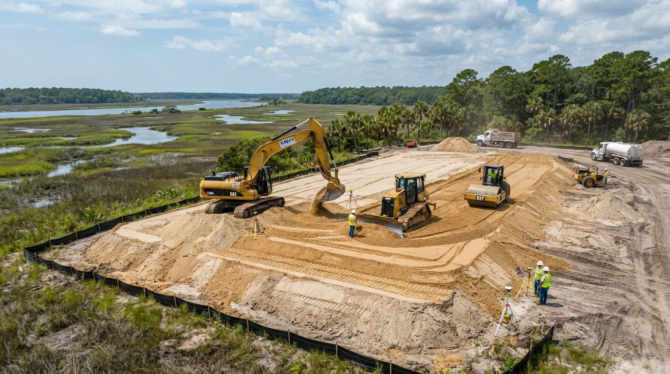
Pad preparation involves suitable fill placement, approved grading, equipment access, and project-specific construction requirements. Fill material, lift thickness, and compaction may need to meet specifications from approved plans or a geotechnical evaluation. Groundwater, soil conditions, existing drainage, and neighboring properties all influence how the pad is built. The physical work follows the approved design rather than independent field decisions about elevations.
Planning Elevated Building Pads near Myrtle Beach
Planning an elevated pad begins with the flood and elevation information that defines the applicable requirements, then coordinates the fill and site preparation under the approved plans.
Reviewing Flood Maps and Approved Plans
Useful information includes FEMA flood maps and the applicable map panel and effective date, property-specific flood information, a certified elevation survey, approved site plans, the local floodplain administrator's requirements, and the applicable elevation datum. The mapped zone, any freeboard or offset, and the approved building location establish the target pad and finished floor elevations. Horry County floodplain guidance may apply where jurisdictionally relevant, but the actual municipality and floodplain authority must be confirmed for the specific parcel.
Coordinating Fill and Site Preparation
Coordination covers required fill material, fill placement, drainage effects, soil conditions, approved grades, and testing or inspections where required. Suitable fill, proper lift thickness, moisture, and compaction may need to meet specifications from approved plans or a geotechnical evaluation. Engineering, surveying, and floodplain certification are professional responsibilities separate from the physical earthwork. We perform the pad preparation under the approved design rather than determining the required elevations or certifying compliance.
Floodplain Site Preparation Considerations in Myrtle Beach
Several conditions and limitations affect whether and how a building pad can be elevated on a floodplain property. These factors shape the scope and must be confirmed through the appropriate review.
Factors That Influence Floodplain Pad Preparation
- Floodplain and floodway restrictions
- Coastal high-hazard conditions where applicable
- Possible limitations on fill placement
- Groundwater and water table conditions
- Existing drainage patterns
- Wetlands and environmentally sensitive areas
- Adjacent properties and drainage impacts
- Construction-specific elevation requirements
- Soil and geotechnical conditions
- Applicable local floodplain review and permits
Raising a building pad does not remove a flood-zone designation, guarantee flood protection, automatically satisfy building codes, make every lot buildable, or eliminate the need for elevation certification. We do not publish a universal fill height or elevation offset — the applicable requirements depend on the property, the local ordinance, and the approved plans. Source references: FEMA Flood Map Service Center (msc.fema.gov); Horry County Build Responsibly guidance; the applicable local floodplain administrator.
Building Pad Elevation FAQs near Myrtle Beach
Discuss Building Pad Elevation in Myrtle Beach
Share the property location, FEMA flood map and zone information, any certified elevation survey, approved site and grading plans, the local floodplain administrator's requirements, and the proposed building location and finished floor elevation. The more complete the elevation and design information, the more productive the discussion about pad preparation, fill, and next steps.