
Specialized Site Work
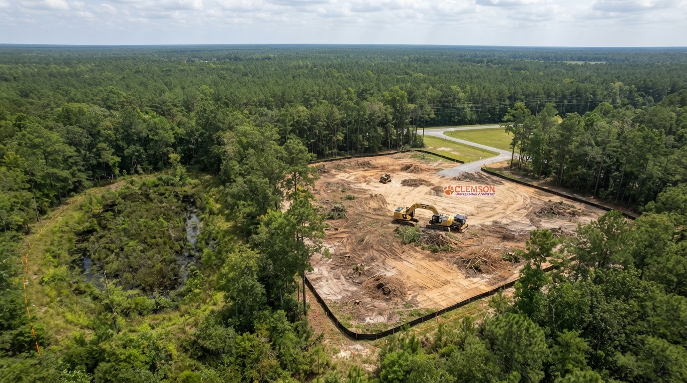
Carolina Bay & Wetland-Adjacent Land Clearing Myrtle Beach
Land clearing near Carolina bays and potential wetlands around Myrtle Beach requires assessing clearing limits before disturbing soil, vegetation, drainage, or fill. The presence of a Carolina bay does not automatically establish federal jurisdiction, and adjacent property is not necessarily protected — but wetland conditions, hydrology, and applicable review may constrain the work. We coordinate clearing within approved limits; the wetland determinations and permits are separate professional and agency responsibilities. Share your property information and we will discuss the clearing scope.
Wetland-Adjacent Land Clearing near Myrtle Beach
Coastal Plain properties may include or adjoin Carolina bay features and potential wetlands. Understanding the site characteristics helps frame the additional assessments and work restrictions that may apply.
Understanding Carolina Bay Landscapes
Carolina bays are distinctive Coastal Plain depressional landforms that may be associated with wetland conditions. Not every bay has identical hydrology, ecological characteristics, or regulatory status — some support jurisdictional wetlands and others have been altered. The presence of a bay is a reason to assess clearing limits, not a determination of jurisdiction or protection by itself.
Clearing Near Potential Wetlands in Myrtle Beach
Clearing near potential wetlands involves work-area boundaries, vegetation, site access, soil disturbance, drainage alteration, fill placement, and project planning. These activities may be constrained by applicable federal, state, and local review. Establishing approved limits before disturbing land helps avoid unauthorized impacts to wetlands or drainage.
Wetland-Adjacent Clearing Versus Ordinary Lot Clearing
Ordinary lot clearing proceeds within standard property and access limits. Wetland-adjacent clearing may require additional assessments, work restrictions, buffer considerations, and agency review before disturbance. The difference reflects the potential presence of regulated aquatic resources and the applicable requirements — not a blanket prohibition on clearing.
Planning Clearing Near Sensitive Land Conditions
Planning wetland-adjacent clearing begins with property information and screening, then establishes approved clearing limits through the appropriate professionals and authorities.
Reviewing Property Information
Useful information includes parcel boundaries, available surveys, site plans, wetland screening maps, existing drainage, vegetation, the proposed clearing area, and owner authorization. National Wetlands Inventory maps may support preliminary screening, but they are not definitive jurisdictional determinations. The more complete the property information, the more accurately the clearing limits and coordination needs can be evaluated.
Establishing Approved Clearing Limits near Myrtle Beach
Approved clearing limits may be established through a qualified environmental professional's assessment, a formal wetland delineation, and — where applicable — a USACE jurisdictional determination and permit. The SCDES Bureau of Coastal Management may also be involved for coastal projects. Sholmes coordinates the clearing within the approved limits rather than performing the delineation or issuing the permits. We do not diagnose wetlands from photographs or claim every wooded depression is jurisdictional.
Carolina Bay Clearing Considerations in Myrtle Beach
Several conditions affect how and whether clearing can proceed near potential wetlands and Carolina bay features. These limitations are confirmed through the applicable review.
Factors That Influence Wetland-Adjacent Clearing
- Potential wetlands and aquatic resources
- Hydrology and seasonal water conditions
- Groundwater and water table
- Existing drainage pathways
- Soil disturbance and erosion
- Material placement and fill
- Access restrictions
- Federal, state, and local review
- Appropriate erosion controls
- Approved clearing limits and buffers
We do not diagnose wetlands from photographs, claim every wooded depression is jurisdictional, promise environmentally unrestricted clearing, encourage drainage or filling of potential wetlands without review, or invent wetland-buffer distances. Source references: USGS Carolina bay background; USFWS National Wetlands Inventory; USACE Charleston District; SCDES Bureau of Coastal Management.
Wetland-Adjacent Clearing FAQs near Myrtle Beach
Discuss Wetland-Adjacent Property Clearing near Myrtle Beach
Share the parcel boundaries, available surveys, wetland screening information, existing drainage and vegetation, the proposed clearing area, and any prior delineation or jurisdictional determination. The more complete the property information, the more productive the discussion about clearing limits, coordination, and next steps.